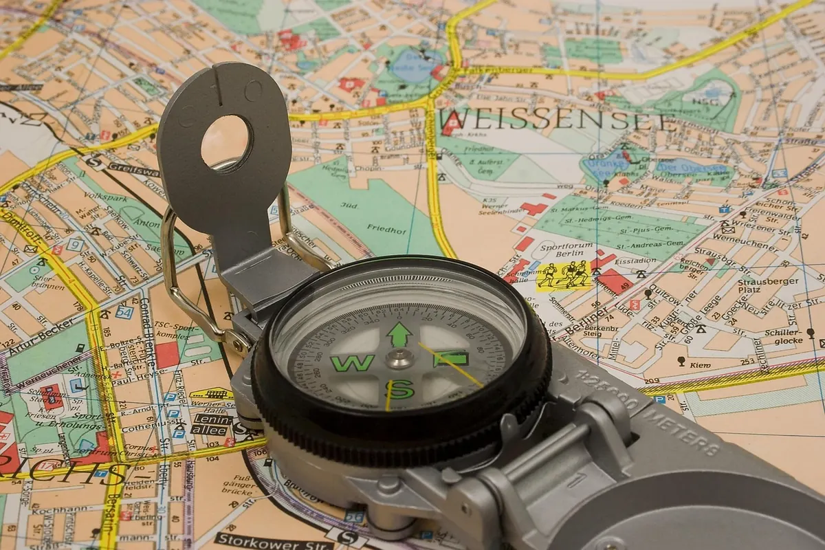
There is a moment on almost every country walk when the route stops being obvious. A footpath sign points one way, the trodden grass goes another, and you are standing at a gate with wet boots and a decision to make. What you pull out of your pocket — a folded map or a phone — says something about how you walk. Neither answer is wrong.
An Ordnance Survey Explorer at 1:25,000 shows field boundaries, fences, small woods, ponds and the difference between a footpath and a bridleway. Landranger sheets at 1:50,000 cover more ground for long days, and Harvey’s maps handle open moorland with a clarity all their own. Contours tell you what your legs already suspect. Access land is shaded, so you can see where you may roam and where you must stay on the line.
The real advantage is that a map asks you to look at the ground. Fold it to the section you need, orient it with a compass, and match the shape of the land to the paper. That skill works in a cold mist when a screen has gone black. Maps never need a signal, never lose a satellite fix, and a laminated sheet survives a soaking. If it blows into a bog, you have lost a few pounds rather than your whole means of navigation.
The limits are obvious. A map does not know where you are. It covers a fixed area, so a route crossing two sheets means carrying two. And reprints lag behind reality — a path diverted three years ago may still be drawn in the old place.
An app puts a blue dot on the map and tells you where you stand within seconds. That is genuinely useful when a path vanishes into a field of oilseed rape, or when you arrive somewhere in the dark. Most apps also give distance covered, height climbed, estimated time remaining and an elevation profile — far easier than counting contour lines with cold fingers.
Beyond position, apps handle the fiddly parts. You can download a route before you leave, share your live location with someone at home, read recent reports about a stile that has collapsed, or record a walk to repeat later. The OS Maps app, Komoot, AllTrails and Outdooractive all do versions of this, and most accept GPX files, so you can plan on a laptop and carry the result on your phone.
Signal in the UK countryside is patchy, and a route that only loads with a connection is no route at all. Download the tiles for the whole walk, plus a margin around it, before you set off. Then test it: switch the phone to airplane mode in the car park and check the map appears, the position marker moves and the route line is there. Do that once at home and you will not be caught out on the hill.
Screen time is the drain, not the satellite. A phone with the display on for six hours will not last, whatever the settings promise. Airplane mode stops the constant searching for signal, and turning the brightness right down makes a surprising difference. Keep the phone in an inside chest pocket rather than a rucksack lid: batteries perform worse in the cold, and body heat is free. Carry a power bank if you intend to use an app all day, and know roughly what it will give you — a small top-up pack is not the same as a spare battery. Pubs, cafés and village halls are not charging points, so do not build a plan around them.
Apps rely on data that may be years old, and paper maps are surveys frozen at the date of printing. Neither is a legal record of where you may walk. In England and Wales that record is the definitive map and statement held by the local highway authority; in Scotland the right of access is broader and set out in law. Signs get moved, stiles are replaced by gates, crops rotate and permissive paths are withdrawn. If a path is blocked, a sign missing or a footbridge gone, report it to the local rights of way team with a grid reference and a photograph. It is a small thing that keeps routes usable for everyone.
For most UK countryside routes the answer is both, with a clear division of labour. A paper map and compass are the dependable base: they work in rain and cold, and reading them makes you better at noticing the land around you. The app is the convenience — a quick position check, a record of the day, a route shared before you set off.
If map reading is new to you, the basics are worth a couple of evenings: grid references, measuring distance along a path, setting a bearing and following it. Those skills do not need charging. If you are already confident, an app will save time and let you walk further without unfolding anything.
Nothing here replaces judgement about weather, daylight and your own energy. On remote ground, tell someone your plan, know how to raise the alarm if something goes wrong, and turn back when the conditions say so. The best navigation kit is the one you have practised with — on a short, familiar walk, before the day you really need it.
Photo: Piotr_Ra / Pixabay
How to walk through British villages and farmland without causing offence: gates, livestock, driveways, rights of...

A first-timer's guide to the South West Coast Path: reading tides, staying safe near cliff edges, judging distances...

A practical guide to minimising your impact on the British countryside, covering path use, waste, wildlife...

Exploring paths, places, and stories of rural Britain..
